Franklin County, ID – 6/13/2026
Trip Stats (Click here)
Summit Elevation: 9,489 ft.
Trip Distance: 2.24miles
Total Vert: 1,017 ft.
Travel Type: Hiking off ADV motorcycle
I’m not sure if I ever thought that doing the Idaho county high points would be easy when I began the task, but I also didn’t think they would make me work so hard at times. It seems like the seemingly easy ones are the trickiest to figure out. In fact, at the time I’m writing this I think I’ve attempted 3 high points that I wasn’t able to summit due to weather, access, or daylight that I really thought would work out. I guess it just adds to the adventure.
Attempt #1
I attempted the Franklin County High Point (boringly named) the first time in November 2024. My dad and I took the day off work to see if we could knock it off the list. November was a little late in the year, but on a map it seemed pretty straightforward and the weather had been fair and warm. A drive to southern Idaho, followed by a few miles of gravel road, and a steep mile jaunt to the high point. Simple… Or so we thought.
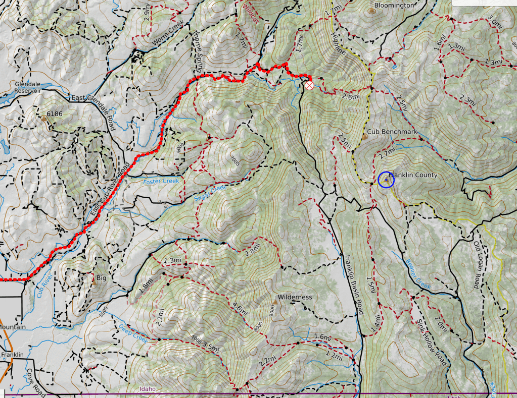
We figured the quickest way was to start off by driving the ol’ beater Subaru to Franklin, ID before heading down East Cub River Road. The road began to climb gradually and a skiff of snow was showing on the ground but we didn’t worry too much. As we rounded the corner near Willow Flat Campground onto Hillyard Canyon Road (30406) we found that the grade became significantly more steep and the road became quite a bit more rough. A couple side-by-sides passed us and were able to climb it, but it would be difficult in the snow without 4WD and some clearance.
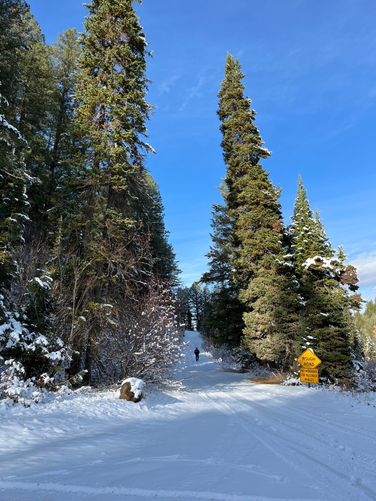
At that point it was still early in the day so after a few minutes of debate, we decided to give it a go from the other side of the mountain range. So we retraced our tracks back to Franklin and drove all the way around the south end of the range and through Logan, UT, stopping at the Pepperidge Farms warehouse store to buy some cookies. After a few sweets and a long drive up a section of Logan Canyon Scenic Byway (Highway 89) We found our way to the foot of Beaver Mountain Ski Area. The road from this direction didn’t seem to be as long and we were hoping by mid-day the snow would bake off a bit and we would be able to make our way up to the foot of the mountain. Again, this would not be the case.
While we were able to creep our way up the Beaver Creek Road (FR 011) a few miles, it was just too narrow and slick to keep going and we decided to turn around. The drive out was nerve wracking as we attempted to keep the car from sliding into the steep creek bank, but we made it back out. After some pizza and a soak in Lava Hot Springs to at least make the day feel worthwhile, we headed home. The day wasn’t a total waste, the drive was pretty and the way to the HP was a bit more clear.
Attempt #2
The second attempt at the Franklin County High Point came over a year and a half later in June 2026. With the update of a new adventure partner and a more fun mode of travel than a worn out Subaru, My girlfriend and I set off at about 9am on our ADV/Enduro bikes to make the long trek toward the Utah border.
Part of the reason I initially bought an Adventure motorcycle was to help this project by making some of the long rocky dirt roads to county HPs a little more fun, so we opted to add some gravel roads to the day. Instead of taking the highway, we journeyed southwest east of Idaho Falls and headed out through Bone; following the Blackfoot Reservoir road all the way to Soda Springs. When we stopped for a drink we were still feeling fresh and decided that we could make it all the way if we kept on trucking.
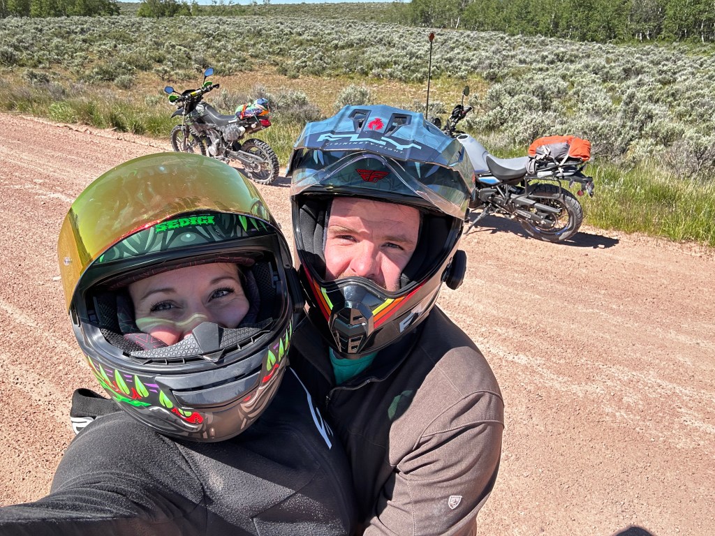
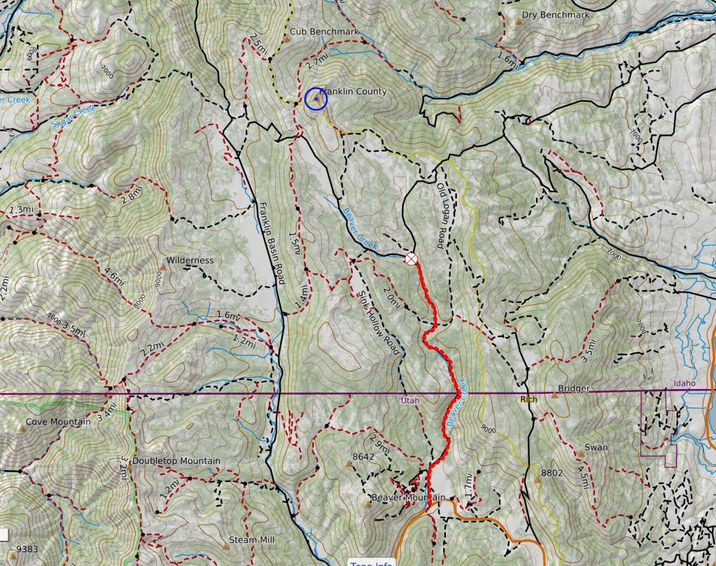
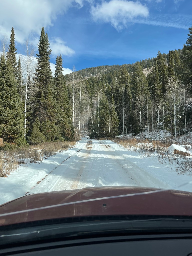
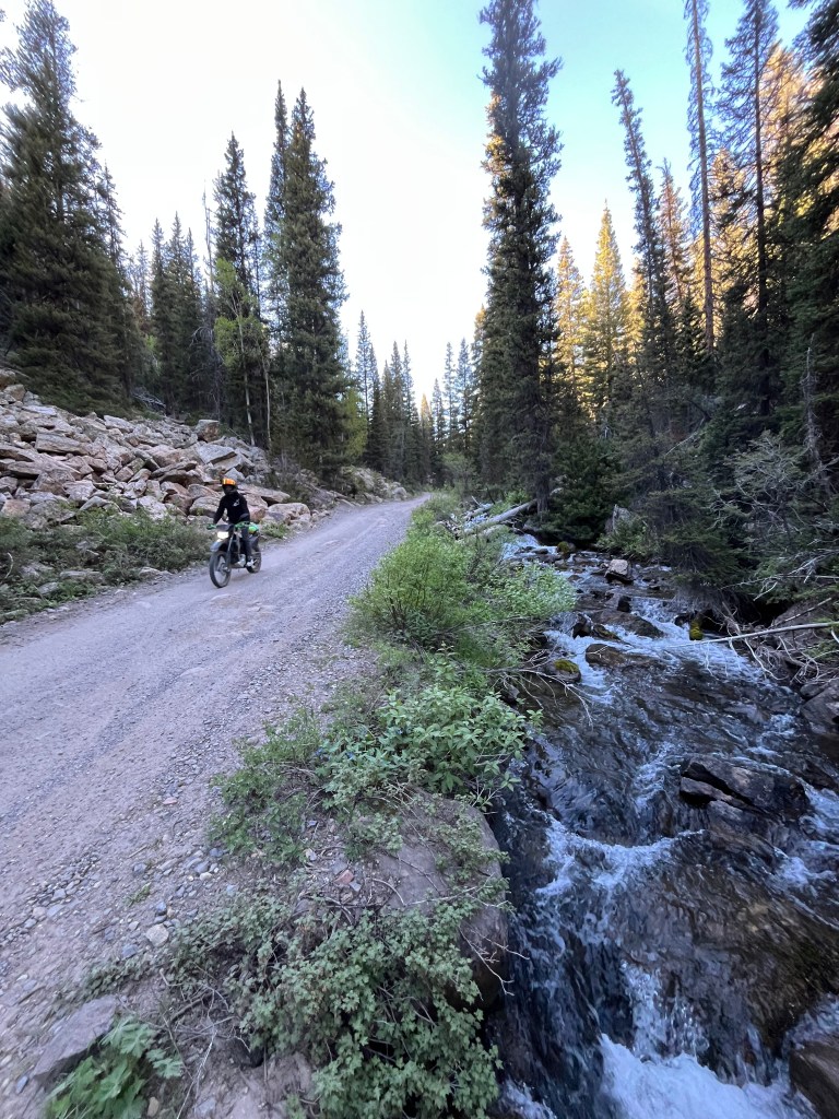
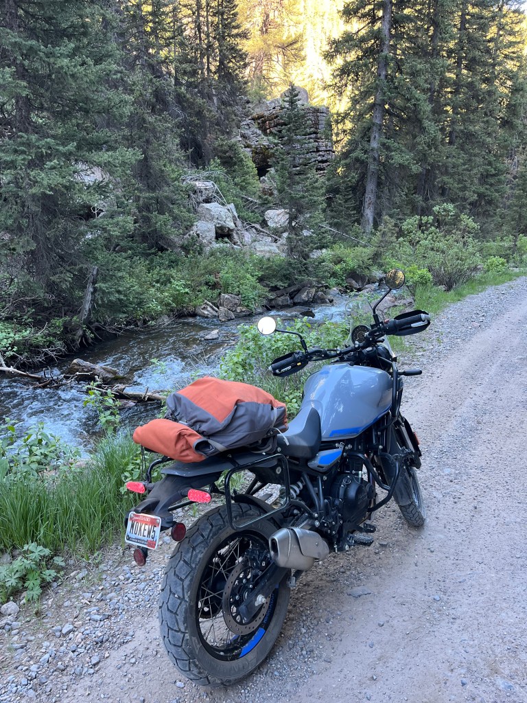
We then continued on ID HWY 30 toward Bear Lake and Garden City. After a sunny but uneventful ride we stopped and had some exceptional lunch in Garden City with some amazing mozzarella sticks. After lunch we headed up the switchbacks west of Bear Lake back toward Beaver Ski Area. This go round, I looked at the maps a little closer and decided that the Beaver Creek was not the best entrance and instead opted for the slightly longer but more traveled Franklin Basin Road (FR006) This road was about 13.5 miles of gravel and all but the last mile or 2 were pretty well maintained. It also passes through some alpine-ish meadows that are absolutely stunning.
Em and I cruised up the road in the afternoon sun, passing campers and making our way along on our trusty steel steeds. The last mile or so to the peak did have some switch backs that would probably be difficult without 4WD but they might be passable if you were careful and methodical. After most of the morning spent on our bikes, we finally arrived at human powered portion of the trip.
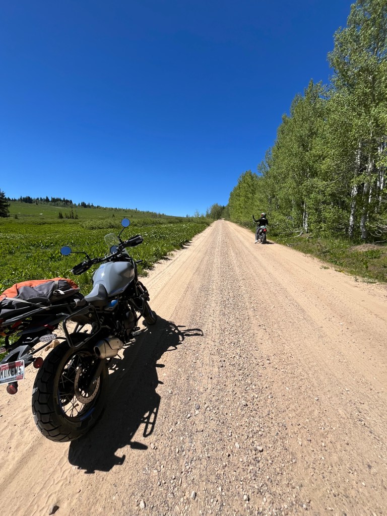
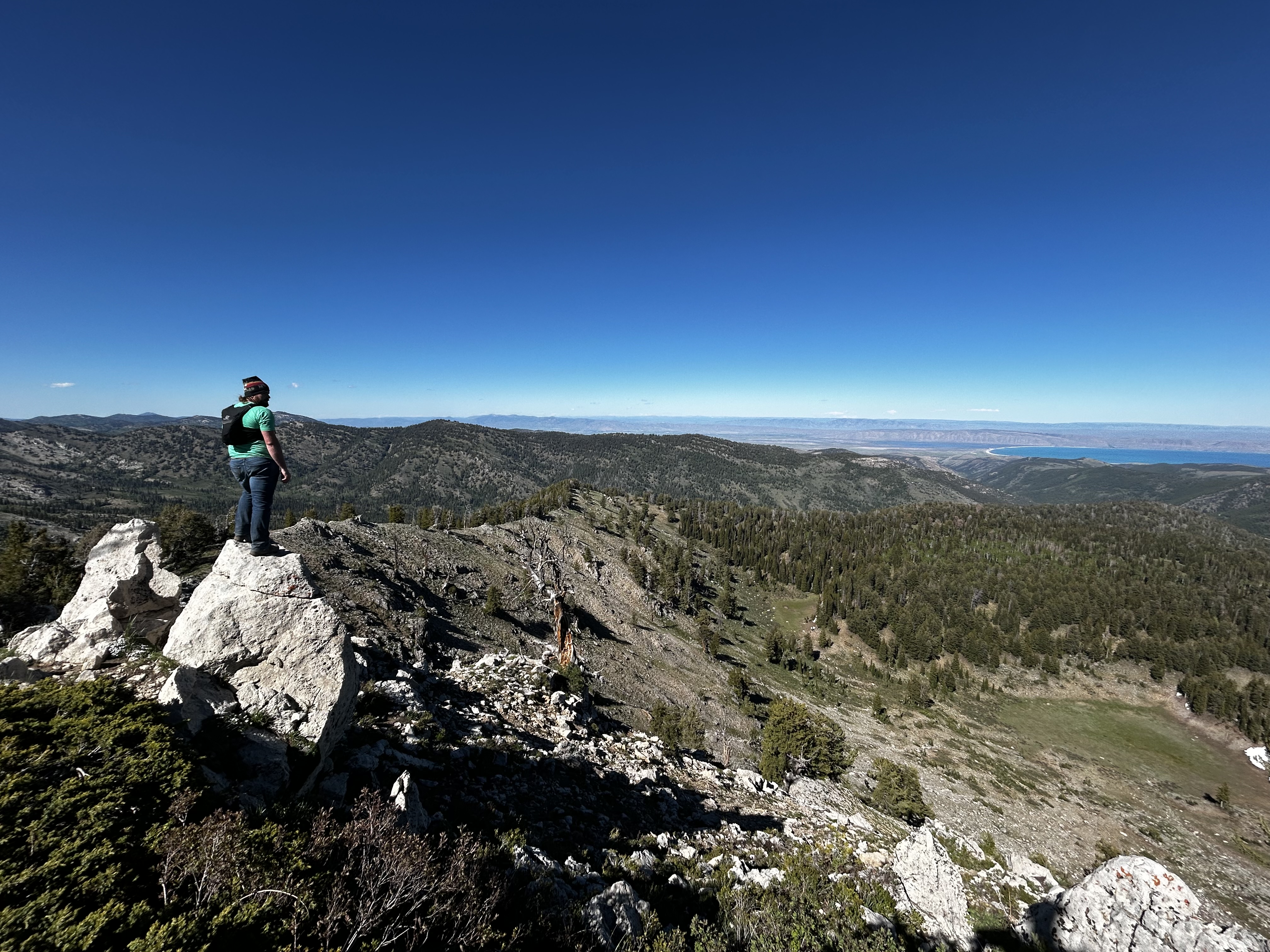
We parked the bikes and gear in a little grove at the bottom of the hill and set off on our hike. The hike to the summit is only about 1 mile but it is pretty steep with no real trail to speak of. We just pointed toward the summit and started climbing until we found somewhat of a ridge and followed that 1000-ish feet to a small bowl like meadow guarding the summit. It was somewhat late in the day but we had finally made it to the Franklin County Highpoint.
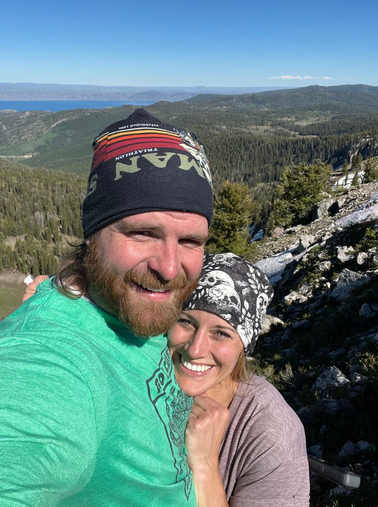
Surprisingly, you can see about half of the Caribbean of there rockies (Bear Lake) from the summit. We snapped some pictures, danced, and looked for a summit marker which we never found, probably due to a large spruce bush covering the summit block. We did however find a large hive(?) of lady bugs. The weather was perfect, the summit was gorgeous, and the company was great.
Before long we decided it was probably time to head back because all the days motorcycling had to be done again in reverse order to make it home so we laughed and joked our way down the short hillside back to our bikes.
At this point in the story I would love to be able to share an easy “we then rode back home with no issues” but instead this would be a true first Adventure Ride for both of us. First, we decided to ride out Beaver Creek Road (the way my dad and I had tried 18 months earlier) thinking it would be shorter because it was about 10 miles rather than 13+. While it is shorter it is also much rougher. The road is rocky pretty much from start to finish and took us longer. Riding down it, I was impressed we got the Subaru as far as we did in the snow.
After what seemed a lifetime we finally made it back toward the highway. We rode on for a bit and decided that no matter what happened we would be riding in the dark, so we decided to soak in Lava Hot Springs on the way home. This was a much needed break because Em was getting cold, my hands were getting achy, and the bikes needed fuel. We enjoyed the hot pools for about an hour hoping that would be enough to rejuvenate us for the hour and a half ride home in the dark. It didn’t keep us feeling good very long.
We drove out through McCammon and decided to hop northbound on the freeway which, due to a decent headwind, our bikes struggled with. We rode 65 mph against the wind with poor head/taillights for about 30 minutes before we decided it would be smarter and safer to get away from the 80mph traffic and take the Old Highway home. Oh, and I should mention that in addition to the moonless night, the head wind, and the slow speeds, Idaho had been having a strangely cold early summer so the wind chill was probably around 50°F or less the whole way home. By the time we rolled our bikes into the garage and back to a warm shower it was just past midnight. We were frozen and exhausted, but we’d achieved our goal and had a hell of an adventure.
Hilariously, what I thought would be a simple drive and a short hike has probably become one of the most intensive points thus far in my HP journey. The 2 mile round trip/ 1000 foot jaunt involved over 700 miles of driving on 2 modes of transportation with 2 partners over multiple seasons. Some people might ask me why I would go through so much for something that really doesn’t mean much to anyone but me… I guess all I can do is laugh thinking about it.
“Because it’s there…”
– George Mallory

Leave a comment