Teton County, ID High Point – 10/26/2024
Trip Stats (Click here)
Summit Elevation: 9,037 ft.
Trip Distance: 17.0 miles
Total Vert: 5,328 ft.
Travel Type: Trail Running
It’s interesting to me, how sometimes the forest and mountains feel like coming home, and sometimes they feel eerily hollow. I imagine it is probably because nature reflects who we are, not the masks we try to wear. They mirror to us what we truly feel. At times my heart has been full of gladness as the sun shines on a mountain summit, and other times the blowing snow on a ridge seems as inhospitable and hateful as any Dante imagined Hell. While this may seem grim, I think it’s why I keep going back into the mountains time and time again; to see a glimpse of who I am when everything else gets stripped away. My journey to Piney Peak was one of those introspective “stripping” moments in nature.
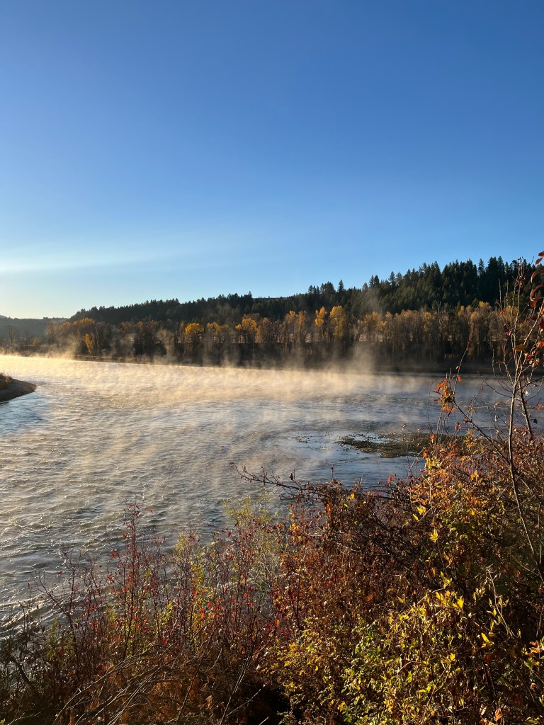
I started the voyage before sunrise. This is an impressive feat for me, but I can learn from past experience. The approach to Piney Peak does not involve entering from Teton Valley, but instead, the most direct route I could devise was once again entering the Big Hole mountains near Ririe, as I previously have done for the Jefferson and Madison county highpoint. While I once again passed Heise, I took a right turn onto East Heise Road just before the slow curve that leads you north into Kelly Canyon. This ended up being a chilly but beautiful drive along the South Fork of the Snake River.
Once I turned off onto E. Heise Road, the pavement quickly ended and began a long 14.8 miles of washboarded road. It would seem that no counties in Idaho nor the National Forest Service own a grader, thank goodness for Subaru suspensions. At mile 12 or so, there is a fork in the road that is somewhat confusing because of multiple “no trespassing” signs around a chunk of private land. The road is still public. If one stays right at this fork the road and will shortly cross a bridge and continue on the last couple miles to the end of the line where there is wide, round parking lot.
I quickly changed my shoes out of my parking lot slippers and headed up the trail. The woods were very quiet but the path surface was great for running. The first couple miles are mostly wide ATV trail, but it hasn’t hardly been chewed up so it’s still soft and easy on the joints. The first rough part of the morning was navigating several creek crossings. Anyone who runs with me often knows that I hate getting my feet wet, so I will go to great lengths to keep my feet dry in the beginning of a run. There are a total of 6 places where you have to cross; 4 that force a runner to ford the creek, and 2 crossings that have bridges. About a mile and a half down the trail I passed an ATV cattle guard and gate, and about a half mile later ATV traffic is halted altogether by a permanent forest service gate leaving the only options as foot-traffic, horse, or bike.
I scurried on up the trail, quickly reaching switchbacks that would begin to haul me up onto the ridge lining the northwest side of Burns canyon. Before climbing west I did bump into a mother moose with a yearling calf not far from where I stood. Luckily they continued deeper into Burns Canyon as I climbed out.

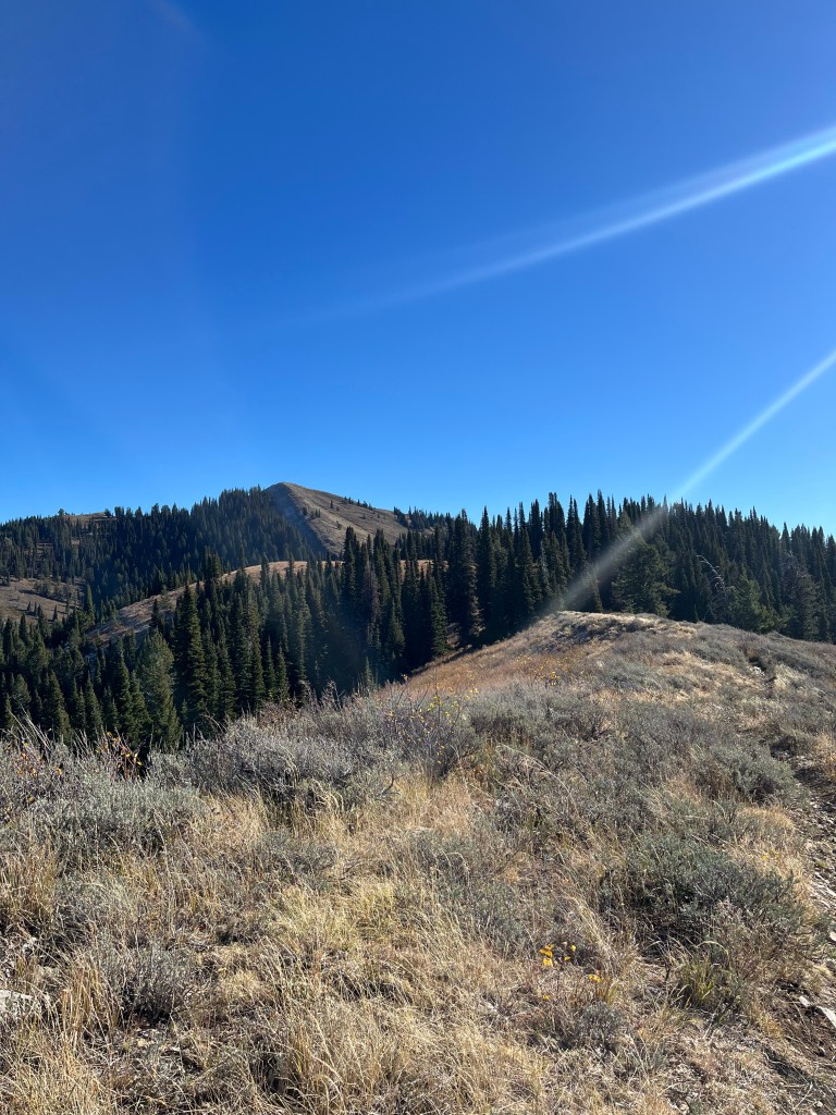
After a couple miles of relatively steep switchbacks I was feeling melancholy, but I was hopeful that this would shift as I reached the ridge. This took longer than expected and only weighed on my soul more, but luckily from the top of the ridge I caught the first glimpse of my destination, Piney Peak. I was also greeted with lovely view of Black Mountain, Chicken Peak, and Liars Peak.

I began to run toward Chicken Peak and sprinted up the west Ridge, and was rewarded with a beautiful view of the Tetons, closer than expected. But after a minute to catch my breath, yet again the wind was taken out of my sails. The trail below seemed farther off and lower in a valley than I had hoped and I was starting to feel relatively tired at this point in the morning. And so, down I trodded heading toward the massive base of Liars Peak. Originally, the plan had been to summit this peak too, but after looking at the map and seeing the steepness of Liars south face, I decided it would be just as good to circumvent the thing. This was the right choice because the opposite side of the mountain reveals a high cliff band that would have been difficult to navigate, followed by a thick pine bushwhack.
One positive to note is that the trails in this part of the Big Hole mountains are excellent. I believe the low traffic in this area makes them a fun combination of soft and moderately technical. The single track around Liars is no exception. After a few minutes, I rounded the bend and finally saw no more peaks and valleys between me and my destination. The track curves into a wide valley and then makes a hard 90 degree turn north. Just 800ft of slow, sagey climb to the summit.
With a little pep-talk, I pushed myself hard to the summit and made it quicker than expected. The views from the top are incredible. As it only has one other mountain of similar height near its base, Garns mountain, you can see a long way in every direction. Mountains in the Teton, Snake River, Grays River, Lost River, Lemhi, and Blackfoot Ranges were all visible from this point in the heart of the Big Hole mountains. The sun was shining but the cold breeze blew gently making the summit seem colder and more secluded. This feeling was only deepened when I looked at my gps watch and realized that the 14.5 miles I had calculated as the days total on the map was well undershot and I still had another 8.5 miles to return to the car.

After a short snack, some pictures of the summit, and saying hello to some impressed dirt bikers, I started my decent. Down the sagebrush meadow, around Liars I went enjoying the trail as best I could with my heart feeling oddly heavy.
I opted to go around Chicken peak on the way back, instead opting for a trail that curls a runner back toward the saddle between Black Mountain and Chicken Peak. I did cut off some of the trail, opting for a steep bushwhack to try and decrease distance, which probably only slowed me down in the long run.

At this point in the day I arrived back at the top of the steep, meandering switchbacks. After having climbed a 5100′ half marathon, I was definitely tired, sore in the knees, and not excited for the wooded slog downward. Usually I enjoy the downhill portions of a run. This would be an exception.
I felt more and more weighed down by my own thoughts, weaknesses, and mistakes as I descended back to the canyon floor. I tried running as much as I could and came to settle on involuntary and ugly, jog-hobble intervals, trying to suffer my way home. I think a few long stressful work days, some personal occurrences from early in the week, and now a longer than expected slog had led me to the point of emotional exhaustion. My body was done, and in the word of an old friend I thought, “get me the f*** off this mountain.” In fact, I was so done, that when I came to the creek crossings I just sloshed on through. Every once in a while I surprise myself with the forethought of dry socks at the car.
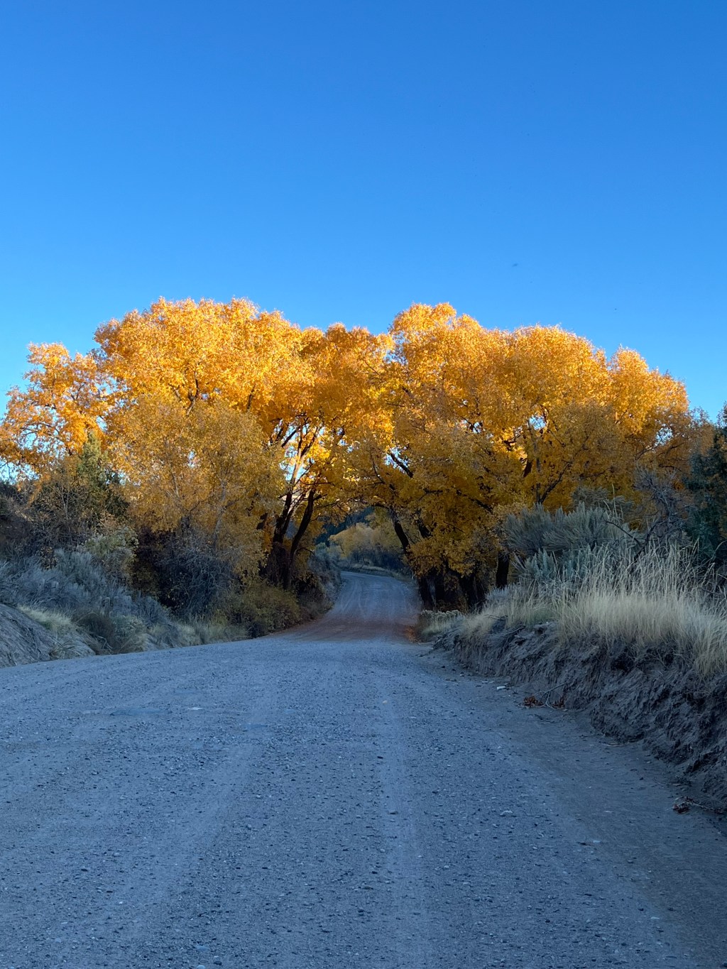
Ultimately, it was a long day followed by a long drive home. The sunshine through the yellow leaves lifted my spirits some, but I think we need to appreciate being in those places of hurt, pain, and loneliness. Sometimes there’s nothing to do but feel the pain. Six miles away from your car, on a trail with little-to-no traffic, there’s not much you can do to stop the pain. As it is on the trail, so often it is in life. Sometimes we need to just feel the pain and suffering because it can teach us a lot about ourselves and the life we continue to live.
Sadly, the colors were a little more flat and the world a little more dim as I climbed down from Piney Peak, but that’s actually okay. It might make the good days just a little sweeter.

“Keep close to Nature’s heart and break clear away, once in a while, and climb a mountain or spend a week in the woods. Wash your spirit clean.”
-John Muir

Leave a comment